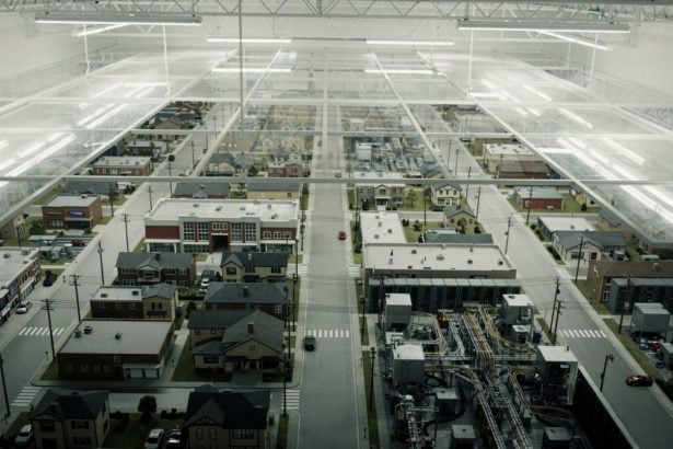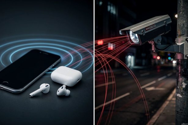


A San Francisco police drone captured footage of an innocent person through a window for minutes without their knowledge—and nobody realized it until the video leaked.
- How Did Autonomous Drones Escape the Rules That Governed Police Surveillance?
- Who Is Building the Infrastructure—and What Are They Collecting?
- Does This Data Architecture Mirror What Cambridge Analytica Built?
- What Legal Protections Actually Exist—and Where Do They Fail?
- What Does This Mean for Anyone Living Under a DFR Program?
- Can Communities Still Say No?
That single incident, documented in 2026, reveals a surveillance expansion unfolding across America right now. Over 1,000 public safety agencies—police departments, fire departments, emergency management offices—have obtained the regulatory green light to deploy autonomous, AI-powered drones that can watch backyards, roofs, and through windows without a human pilot controlling them. Most Americans have no idea this is happening in their communities.
- The Waiver Surge: The FAA issued more drone deployment waivers in ten months (April 2025 to February 2026) than it had in the previous seven years combined.
- The Surveillance Gap: Drone surveillance operates without warrant requirements, judicial approval, or mandatory public notice in most U.S. states—a legal gray zone that patrol officers on the ground do not enjoy.
- The Data Pipeline: Flock Safety’s drone platform now functions as a flying automated license plate reader, converting every flight into a searchable database of vehicle movements and locations.
As of February 2026, according to a Freedom of Information Act release, more than 1,000 agencies had received Federal Aviation Administration Part 91 waivers needed to automate drone operations and launch what’s called a “drone-as-first-responder” (DFR) program. The speed of this expansion is staggering. Between April 2025 and February 2026—just ten months—the FAA issued more waivers than it had in the previous seven years combined. Only 976 DFR waivers existed from 2018 through April 2025. The agency’s streamlined approval process, introduced in April 2025, transformed what had been a trickle into a flood.
The shift represents something fundamental: law enforcement is moving from human-operated aerial surveillance to fully autonomous AI-based drone use. Understanding the architecture of that shift—and who profits from it—is essential to understanding what is actually being built above American neighborhoods.
How Did Autonomous Drones Escape the Rules That Governed Police Surveillance?
Until recently, FAA rules required a human operator to manually fly a police drone, and only within their line of sight. Flying “Beyond Visual Line of Sight” (BVLOS)—from a desk inside a building to a call across the city—required additional FAA approval. So did flights above 200 feet. These restrictions existed because drones can collide with aircraft. But DFR technology has changed the equation. Modern systems use artificial intelligence to automate drone flights from launchpads placed atop municipal buildings around a city. One operator can now “fly” multiple devices simultaneously. The technology handles navigation, obstacle avoidance, and scene assessment without human intervention. Every department on the FAA’s waiver list has signaled strong enough interest to clear the regulatory hurdles—meaning they’re prepared to deploy.
Police departments and the companies selling this equipment claim autonomous drones establish “situational awareness” before officers arrive at a scene. The pitch centers on high-risk situations: vehicular accidents, armed suspects, hostage scenarios. But real-world deployment tells a different story. A Government Technology analysis of Chula Vista, California’s system found that drones were frequently dispatched for low-risk calls—responses to unhoused people, mental health concerns, and even loud music complaints. Backyards and roofs become visible to cameras in ways patrol officers on the street cannot access. Windows become transparent to overhead sensors. The gap between the stated justification and the operational reality is not incidental—it is a pattern that has defined the expansion of police surveillance technology for decades, as research from the Brookings Institution on police surveillance and community data privacy has consistently documented.
• More than 1,000 U.S. public safety agencies held active FAA DFR waivers as of February 2026
• 976 total waivers were issued across the entire period from 2018 through April 2025—a number surpassed in under ten months after the FAA’s streamlined process launched
• Campbell Police Department, California, became the first agency approved for round-the-clock BVLOS drone operations using radar and electro-optical sensors in October 2024
Who Is Building the Infrastructure—and What Are They Collecting?
The financial incentive driving this expansion is enormous. Companies like Flock Safety and Axon have made DFR platforms central to their growth strategies. Axon, which manufactures TASERs and the Fusus camera system that integrates public and private surveillance feeds, has reported that its DFR platform is now one of the company’s fastest-growing sectors. Drone footage streams back to police offices where it can be stored, shared, and analyzed like any other video evidence. But the data pipeline does not stop at video.
Flock Safety quietly transformed its drones into “flying automated license plate readers” last year—requiring minimal additional software. A single drone flight now produces not just video of a scene, but a database of every vehicle license plate visible from above. Location. Time. Direction of travel. Vehicle type. All of it indexed and searchable. The transformation from aerial observation tool to mass data harvesting instrument happened without public debate, without legislative approval, and without most communities knowing it occurred.
Does This Data Architecture Mirror What Cambridge Analytica Built?
This is where the surveillance architecture becomes something darker than simple aerial observation. The data collection mechanism—drones capturing video, extracting license plates, feeding that information into networked systems—mirrors the behavioral data harvesting that defined the Cambridge Analytica scandal. In that 2016 case, a political consulting firm harvested psychological profiles on 87 million Facebook users without consent, then micro-targeted them with tailored messaging based on their inferred vulnerabilities.
The mechanism was different—social media rather than drones—but the structural logic was identical: collect granular data at scale, extract actionable intelligence about individuals, integrate that intelligence into systems that shape behavior and decision-making. The legacy of that model is now visible in physical surveillance infrastructure. With police drones, the data collected is location and movement history. The system that receives it is law enforcement. The behavioral inference drawn is about where you go, who you visit, what you own. The integration point is police databases that inform stops, searches, and arrests. Cambridge Analytica’s architects understood that data about behavior, aggregated at scale and fed into a decision system, becomes a tool of control. The drone-as-first-responder architecture is that same logic applied to public space.
• The Police Executive Research Forum’s report on drone use by public safety agencies, produced with U.S. Department of Justice support, identified the absence of standardized deployment policies as the central governance failure in law enforcement drone programs
• Departments acquiring DFR capability frequently do so before establishing use-of-force policies, data retention rules, or community notification procedures
• The result is a technology deployment pattern where capability consistently precedes accountability—a sequence that has defined the expansion of every major police surveillance tool from body cameras to facial recognition
What Legal Protections Actually Exist—and Where Do They Fail?
What makes this expansion particularly significant is the absence of meaningful legal friction. Unlike wiretapping, which requires a warrant, or traditional search warrants, which require probable cause and judicial approval, drone surveillance operates in a regulatory gray zone. The FAA approves the technical capability. Local police departments decide deployment policy. Communities often learn about programs after they’re already operational.
California’s AB 481 law requires police to provide advance notice of intent to acquire drones and establish policies before purchase—giving communities a chance to object. But most states have no such requirement. A police department can obtain a waiver, purchase equipment, and begin flying without public knowledge or consent. The same dynamic that allowed shadow data collection to flourish in the digital advertising ecosystem—where data harvesting proceeded invisibly until exposure forced accountability—is now operating in physical airspace.
Campbell Police Department in California pushed the envelope further. In October 2024, it announced the first FAA approval for BVLOS drone operations at night, using radar technology combined with electro-optical sensors. A single remote pilot can now safely deploy drones around the clock. Darkness no longer limits aerial surveillance.
What Does This Mean for Anyone Living Under a DFR Program?
The San Francisco Police Department leak showed how easily drones observe innocent people without awareness. Footage captured a person through a window for minutes. They never knew they were being watched. That is the lived experience of autonomous drone surveillance: it operates in the space between your backyard and the sky, invisible until the moment footage surfaces in a criminal investigation or an internal leak exposes it.
For your own privacy, the implications are concrete. If you live in one of the 1,000-plus jurisdictions with an approved DFR waiver, an autonomous drone could be dispatched to your neighborhood right now in response to a call you never made. It could capture your backyard, your roof, your movements through windows. That footage could be stored indefinitely, shared with other agencies, analyzed by automated systems, or fed into license plate databases. You would have no way to know it happened. No warrant was required. No judge approved it. No notice was given.
• Brookings Institution analysis of police surveillance technology documents that communities of color bear disproportionate exposure to aerial and facial recognition surveillance, with deployment concentrated in lower-income urban neighborhoods regardless of crime rate differentials
• Surveillance tools introduced for high-risk scenarios consistently migrate toward routine use within 18 to 24 months of deployment, a pattern documented across body cameras, license plate readers, and predictive policing software
• Absence of mandatory data retention limits means drone footage collected today may remain in law enforcement databases indefinitely, available for future investigations into conduct not yet criminalized
Can Communities Still Say No?
Communities considering drone adoption face a critical choice. Many cities now maintain flight logs showing paths and reasons for each deployment in real time—an important transparency practice. But transparency after the fact is not the same as consent before deployment. The question is not just how drones will be used once purchased. It is whether they should be purchased at all. Clear policies on appropriate use, regular public re-evaluation, and the explicit option to discontinue a program are vital. So is the right to say no before the first drone launches.
The next question is whether that choice will remain available as autonomous drone deployment becomes normalized across the country. The FAA’s streamlined approval process—which converted seven years of cautious waiver issuance into ten months of mass authorization—suggests the window for meaningful community input is closing faster than most people realize. The infrastructure is being built now. The data is being collected now. The decisions about whether any of this requires democratic accountability have not yet been made.